Speaker

Conferences agenda
Videos of the conferences
Videos of Joël Supéry’s conferences will be published very soon.
Cartography
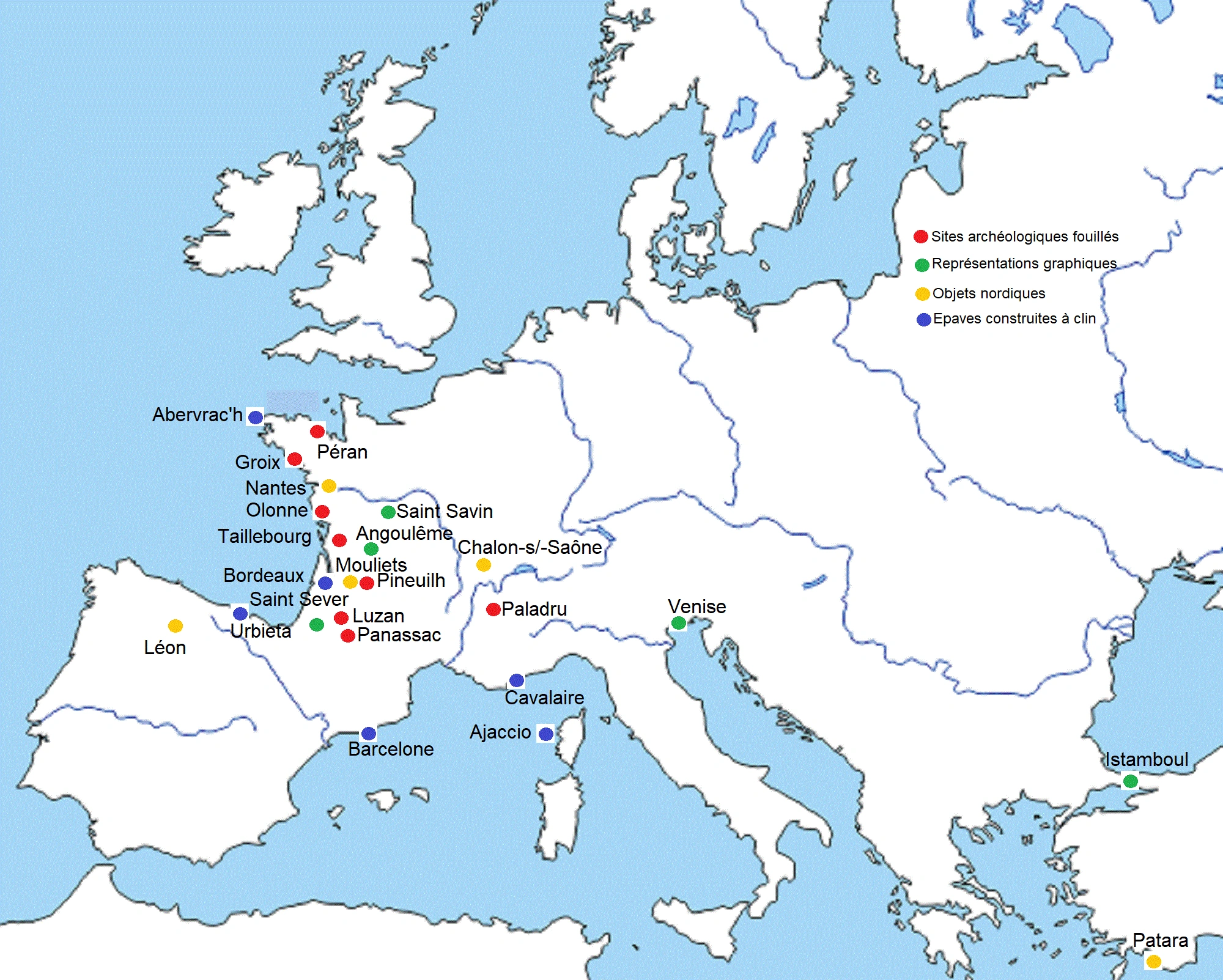
For three centuries, the men of the North will extend their actions on four continents. These sailors and traders were primarily interested in the trade routes crisscrossing Europe. This mapping aims to make us understand, from the first glance, the commercial and geostrategic logics that underlie their motivations, far removed from an overflow of unscrupulous and objective looters.
Map number 1
This first map shows that the south has not been spared by the men of the north and that they have left traces that are still more numerous. This map evokes archaeological, graphic, ethnological, folkloric traces of the passage of northern men in the southern half of Europe (the discoveries made beyond the Channel are not mentioned).
Legend:
Orange Square: Viking archaeological site and identified as such.
Black Square: archaeological site suspected of being a Viking, but removed
Yellow Square: excavated archaeological site that can be attributed to Northerners.
Green Square: presumed Viking site, not yet excavated.
Goutte jaune: isolated archaeological object discovered by chance.
Navy blue drop: shipwrecks of traditional Nordic ships
Red drops: graphic representations evoking the men of the North or their heritage.
Goutte bleu ciel: legends and traditions related to the Vikings.
Goutte orange: ethnological trace of the passage of the men of the North.
Goutte noir: suspicious trace of the passage of the men of the North.
Map number 2
Indicative map of the traces left by northern men in the southern half of Europe.
It can be seen that the southwestern quarter of France has been greatly affected by their presence.